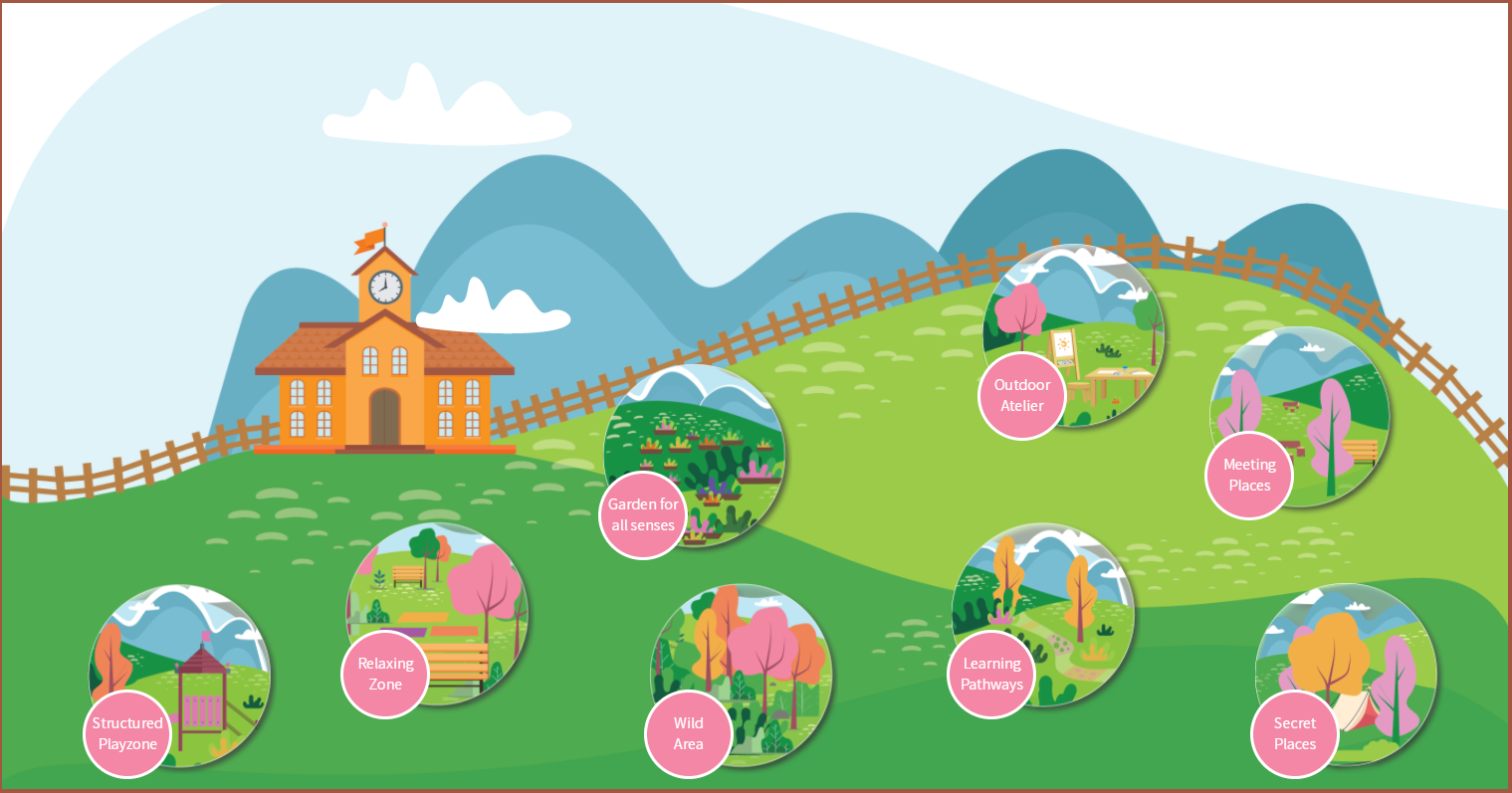
The DEHORS consortium is proud to announce the release of the Online Interactive Map of the project. Having completed two (2) workshops engaging pre-school teachers and experts from different European countries, together with some coordination meetings of the consortium, a map was developed comprising of eight (8) different areas. Those areas refer to the outdoor environment, which can be enhanced in order to be stimulating and inviting for children. Different experts from the field of Early Childhood Education and Care, as well as landscape architecture, have contributed in the development of the map for its maximum impact. In addition, the map is also employing the ‘Evaluation Model of the 7 Cs (Herrington, Brunelle and Brussoni, 2017), which has been proven to be very beneficial for children’s academic and socioemotional development. Specifically, the 7 Cs refer to ‘Character, Context, Connectivity, Clarity, Chance, Change and Challenge’, which are all elements that should be taken into account when pursuing outdoors education.
As illustrated below, the eight (8) areas developed are the following: Structured Playzone, Relaxing Zone, Wild Area, Learning Pathways, Secret Places, Garden for all Senses, Outdoor Atelier and Meeting Places. Each area provides users with a definition and learning objectives, which are accompanied by relevant activities. The activities for each area have been pilot tested by pre-schools in Cyprus, Latvia, Italy and Sweden. In addition, the users can find relevant literature and the connection to four EU countries’ national curriculum. The next steps of the project include the development of a handbook for teachers and an online environment with Modules on Outdoors Education for pre-schools.